After poking around David Rumsey’s Map Collection for a little while, I georeferenced a map of the Pacific Ocean and the landmasses on either side of it. The map includes all the latitudes of Earth, from Antarctica to the Arctic Ocean. Each of these landmasses provide much better georeference points than the vast emptiness of the Pacific Ocean. I myself placed points on Southeastern Australia, Northeastern Russia, Northern Alaska, Northern New Zealand, and Hawaii. This provided a wide range of georeference points across the map and allowed the algorithm to accurately align the maps.
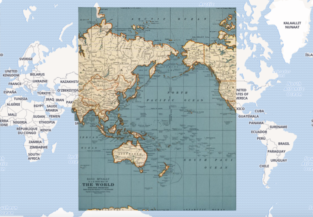
Georectified maps make the process of determining accuracy much easier. For example, I can tell that this map is relatively modern and quite accurate for almost all the landmasses and proportions when compared with the modern day map beneath it. However, it was also very easy to see that the older map inaccurately portrayed the landmasses North of Russia. It shows them as connected when in reality, they are two islands.
Limitations of georeferencing are made most obvious when the work is crowd-sourced like it is on DavidRumsey.com. When poor data is inputted, poor visualizations will be outputted. Each of these maps need to be verified and reverified in order to catch any major errors. Additionally, some maps are so distorted that mere georeference points cannot overlay them accurately with modern maps. In these cases, a side-by-side comparison may prove more effective for whatever larger point someone is trying to argue.
The contexts of various map projections are almost as important as the maps themselves. Understanding who distorted what and why tells a much deeper story of history than just pictures can. Some projections may be distorted in order to argue for the “importance” of a particular landmass over any other. Some projections may be inaccurate simply because of misinformation. Taking a historical map out of context can be dangerous for the integrity of the discipline.
The biggest impact this process had on my understanding of spatial DH projects is just how many of them there can be. David Rumsey’s website has 126,639 maps, and there are a myriad more that haven’t been digitized or maybe that have yet to be created. There are millions of ways to map just one globe, and it’s clear that the field has a lot to offer.
