I georeferenced the map of Northfield’s original plat, 1905-1910. here is my map.
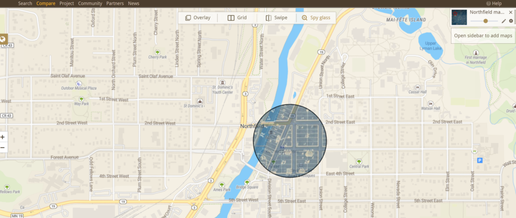
I thought the process was pretty easy. I was able to get a few solid points on the intersections of streets that still exist today. I had a harder time doing this for streets on the left of the river because some of them weren’t aligned properly or were different. Also the highway has changed since then so it was hard to tell if some streets that were near the highway exist today or if some that are there today were there before.
I think it’s cool that you can overlay the maps and that you can make the old map more transparent to allow you to see the differences more clearly. I also think the spy glass feature is really cool because you can see the differences in specific parts of the maps. It would be cool if there was a way to put more than one map and create some sort of timeline with the maps.
I think Georectified maps provide a good way to compare the past and the present. It was interesting to see how much Northfield has grown since 1905-1910, there is a lot that isn’t on the old map.
Although the map explicitly shows property owners by including names and plots of land that were owned by certain people. It can be used for historical contexts outside of property management. They can also give you background information on why some things are different geographically. For example the river looks different, this could lead you to infer that it was redirected to make way for construction of the highway or it has naturally shifted or dried out.
There are many problems with georeferencing. For example, it’s hard to line up old maps with new ones because they were hand drawn usually and some cartographers may have had the proportions wrong, some of them also have bad handwriting that is difficult to understand. Generally if the maps are not easy to read it can be hard to compare them to modern maps.
Doing this process made me appreciate the people who digitized old maps more. It’s hard to read and understand some writing on maps and recreate them.
(375 words)
