This week, I used geo-referencing to overlay an old map of Northfield with a present day Google Maps view of Northfield. Here are the results:
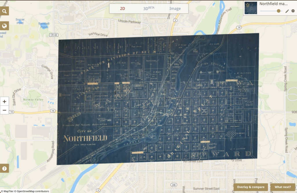
The geo-referencing was imperfect with this map, but generally, I see geo-referencing as a way of connecting the past and the present together. In this map, you can see the typical grid format of the streets of early 20th century Northfield. You can also see how small the Northfield city limits were at the time, as much of the present-day town is left out of the old map.
From here, I would like to find a way to make the old map transparent as a feature, so the user could see both what downtown Northfield looks like today and in the past rather than seeing the old downtown and then everything else on the outside.
The big limitation of geo-referencing is that the process itself can be confusing. To line up the old map with the new map, I had to find streets that existed in both the past and present. That was surprisingly difficult, as many streets on the St. Olaf side of town have been changed and the highway through Northfield has significantly changed in its path. This was a contributing factor to why most of my points on the software, Old Maps Online, were on the Carleton side of town. Another factor is the quality of the old maps, which is something that unfortunately cannot be fixed. Many cartographers drew streets out of proportion or labeled streets incredibly illegibly.
This exercise definitely reminded me that maps can distort peoples’ image of a certain place. It is interesting to see how the layout of Northfield has changed over time, but when too many things change, it can confuse users more than inform them.
