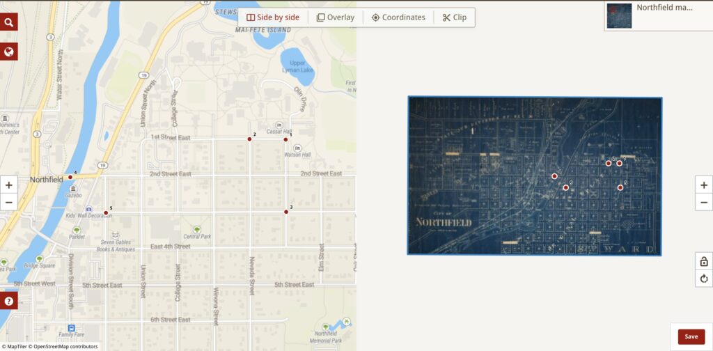
Map of Northfield: https://www.oldmapsonline.org/maps/731495a8-d3cb-4877-9965-dbb03b672b53/
By using five intersection points to georeference a historical map of Northfield, I opened the door to historical research and digital humanities projects. Old documents are brought back to life through this process, becoming geographically precise, multi-layered resources for thorough research. Georectified maps have a wide range of possible uses, and they provide historians with a unique lens through which they can examine the development of locations, buildings, and societal dynamics across time. These georectified maps can be overlaid to show differences and changes between historical periods, offering insights into the small but substantial changes that happened throughout time. Additionally, the ability to make comments on these georectified maps gives the research a level of depth. Researchers, educators, and the general public will find the resource beneficial when it includes detailed labels for buildings, streets, and landmarks. Georeferencing can provide some difficulties, though. Due to the restrictions of their time, historical maps frequently contain errors and distortions. In order to avoid conflicts and guarantee the accuracy of their conclusions, researchers must cross-reference data with other historical sources. Furthermore, it is crucial to comprehend the context, goal, and underlying biases of the original map. These maps require careful examination from historians who are aware of the political and cultural influences that led to their production. A more detailed interpretation of the data is possible because of this knowledge, which also sheds light on the historical narratives that are mixed into these geographical artifacts. Taking part in the georeferencing of the Northfield map really increased my understanding of historical mapping. It highlighted the creativity behind these historical treasures by putting focus on the hard skill required by mappers in a time free of advanced technology. By highlighting the value of contextual knowledge, this experience helped me approach historical maps with a strong understanding of the historical, social, and cultural factors impacting their creation. Through this georeferencing project, I developed a deep understanding for how technology and historical research can work together. As a result, a dynamic interaction was created that not only improved our comprehension of the past but also brought history to life in ways that were not previously possible. Georeferenced maps stop being just records and turn into colorful, layered displays that may be studied, providing a connection to our historical past.

I agree with the importance on the level of detail that can be added with being able to make comments on maps. Having comments would make it way easier to understand what the map maker means by that point. Overlaying different data is definitely where it shines. I do agree that before satellites and accurate cartography historical maps do need to be cross referenced.