The map I got was XXI. Switzerland a map of height based map of Switzerland in 1821. Based on the few words I were able to easily translate the different shaded areas are the parts that different people were responsible for getting the height data for. I think that the next steps after the map has been georectified would be to compare the original to the georectified version to make sure that the original was even accurate enough where this version can be used to analyze anything. After that with this specific map I would compare the height map created in 1821 to the height map we have Switzerland we have today so we know how much its changed and how accurate they were on the map. The distortions in the graph seemed minimal so I think the research could then extend to the different people listed as having collected this data.
After going through this process it gave me a deeper appreciation for the spatial maps that looked good and were easy to use. Many of them did not seem distorted but still felt realistic to actual size. I also cannot imagine how much harder it would be with a more complicated or older map like some of them were. The older back we go the more inaccurate it gets. It does make me wonder though how accurate some of the maps were because they seemed right but also a lot of the graphs I tried to do.
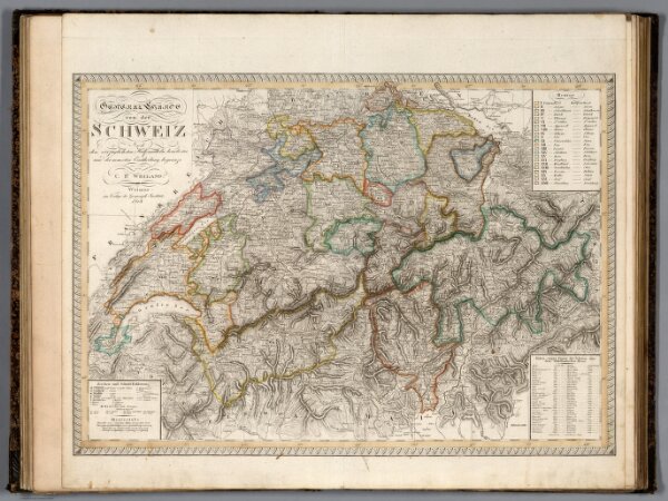

I’m suprised you were able to accurately overlay this map. It’s kind of information overload with all the similarly colored ink being both text description and the geographical features. Having been to the mountains of Switzerland, it is very varied in terrain and I’m surprised that the creator of the original map was as detailed as they were, especially in the early 19th century.