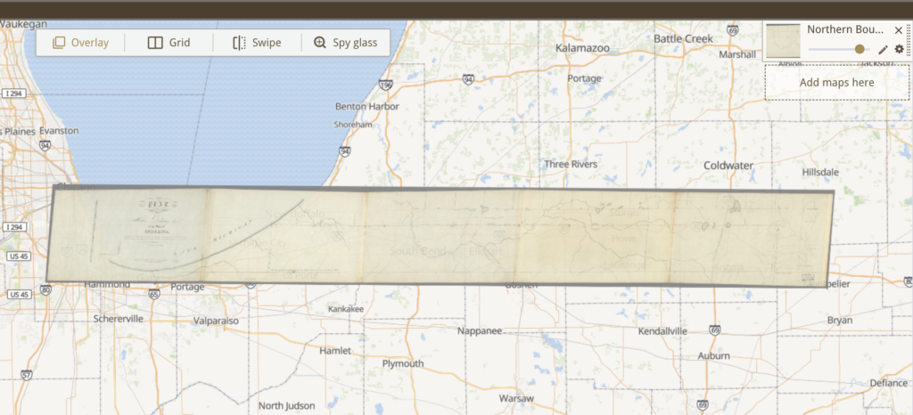
The first couple of maps that the site gave me looked impossible to georeference, as they were mostly weird charts with blocks of text. Eventually, I got this 1827 map of the Indiana State line with a couple of reference points already logged; it just needed a couple more to be completed. Using the other points as a guide, it was pretty easy to complete the georeference the rest of the map and overlay it on a modern map.
The possibilities of this map would be looking at how the waterfront has changed, but also, because the map is so old, just general settlement development of the state. However, A limitation of this map was that it was used to determine the border of Indiana, and therefore doesn’t include much information about the terrain, settlements, or any other comparative data. Its context and purpose were pretty specific and for a sort of one time use, making it not super helpful because of lack of information.
General limitations with georeferencing are the public forum version of it and the nature of terrain and settlements. This site specifically is random users inputting information, meaning that if there is no quality control there is a great possibility for error and misinformation. Even with quality control, there is probably a lot of instances of inaccuracy. In my case, the points plotted before me were from other users, and easily could be wrong or leading me astray. Then, with aligning very old maps, the bodies of waters and settlements could have changed in a way that makes it very difficult or impossible to match up without extensive research or at all.
