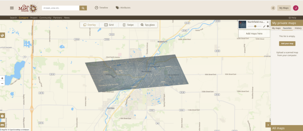
The process of georectifying a map can be both fascinating and challenging, opening up possibilities for historical study and more. For me, navigating the world of georectified maps was slightly messy as I couldn’t seem to find the exact points that lined up with both maps. It ended up in the map overlay being a little crooked and likely inaccurate. I wouldn’t say I’m necessarily proud of my work but it was a learning curve since I hadn’t been exposed to mapping before. Despite this, I found the process enjoyable and didn’t get too frustrated in my efforts. I could see georectified maps used to show contrasts and comparisons for different eras throughout a location’s lifetime. They can also be used to imagine what a place could look like if potential changes are built in the future. Georectified maps are a journey into the past and a glimpse into the future depending on the digital humanists’ intentions behind their work. I think a possible limitation with georeferencing would be how difficult it can be if an older map is completely different from the new map that is placed on the other. I feel this would cause a lot of trouble when trying to line up points in the most accurate way which would make the map inaccurate to what it should look like. If I knew the context of the map I would try to place it on the new map in accordance with what I was looking for in my historical study. I would also be aware of any biases that existed in the original map. I would imagine that some older maps might have a subtly in their biases while others would be more overt so looking for biases is an important step in the georeferencing process. I wouldn’t say this process completely changed my understanding of the spatial DH projects I explored earlier, however, it definitely opened my eyes to the attention to detail and the tedious research process involved when creating maps.
